What is Atlas?
Atlas offers maps and GIS platform to develop Vessel Tracking System (VTS) implementation.
Atlas covers flexible GIS function such as creating custom area (circle/radius, rectangular), measuring distances of 2 custom points, and contextual fraud analytics.
Example of the fraud detection covering anomalies detection of tracked vessels (sailing speed, stopping) detection of suspected illegal contacts, and more.

Below are Atlas key highlights:
On Cloud SaaS
Secure and Scalable Platform
Faster time-to-data
Analytics Ready
Custom Implementation Option
Flexible and Advanced
Map Functions
Data Layer and AIS Integration
Technology
Hassle-Free Solutions
Managed Service
Base Maps
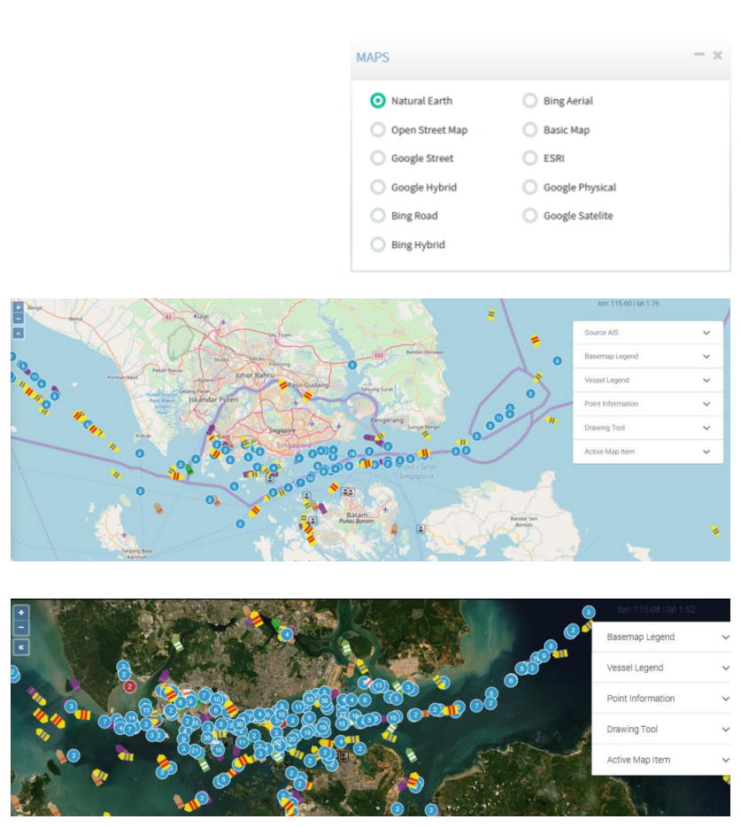
Choose your favourite Base Map
Atlas can use popular Base Maps of
your choice like Bing Maps or
OpenStreetMaps. You could also use
Satellite imagery view.
API Integration
Data Layering
AIS Integration
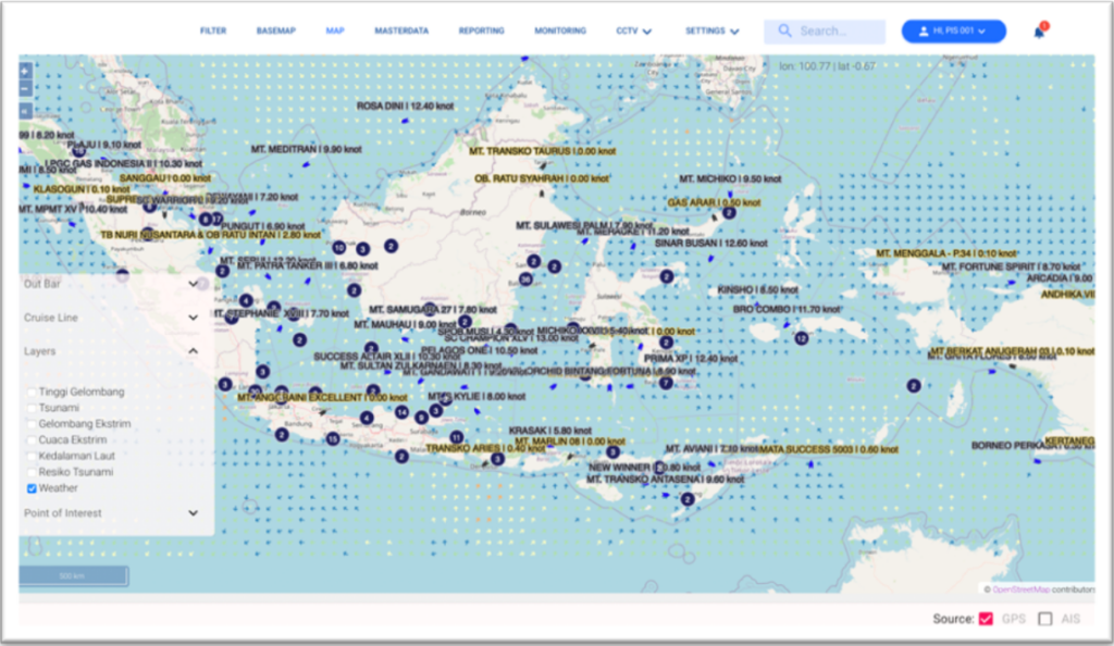
Atlas comes with bundled subscription of AIS data. The integration allows user to search and monitor all vessels registered on AIS API system.
Beside AIS, Atlas already equipped with
earthquake, tsunami, wave, bathymetry and wind speed data from inaRISK and BMKG.
Disclaimer:
additional charge will be applied should there are
additional 3rd party API data integration.
Analytics
Fraud Detections
Anomalies and Potential Fraud Detection
- Slow Speed
- Sailing too fast
- Off-route
- Approaching Vessel (unidentified)
- Draught Change in Open Sea
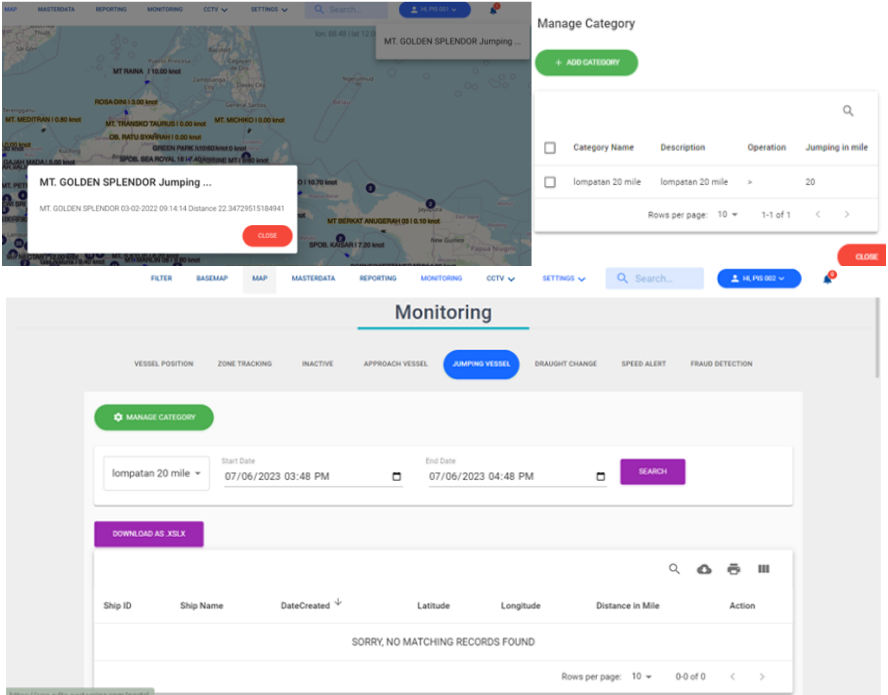
- Vessel Jumping (location)
- Dark Vessels (inactive)
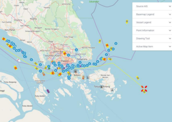
Several anomalies and potential fraud can happen in open sea. Some occurances can be tracked, monitored, and alerted on Atlas. Here is the anomalies and potential fraud detection on Atlas platform:
Alert & Notifications
Inform user regarding to violation occurs, such as over speed and passing restrictied area. This violation parameters can be
set by users. This alert can be shown through apps or push notification via email.
Playback
Historical Vessel Positions
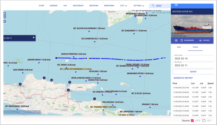
Atlas provided with the capability to display historical vessel positions on map by simply input date range to visualize.
User can also access tabular data in the right panel which contains the time, coordinates and vessel speed.
Vessels with speeds below standard can be marked with different color (marked as yellow color). Atlas can also provide backup and restore data periodically.
Reports
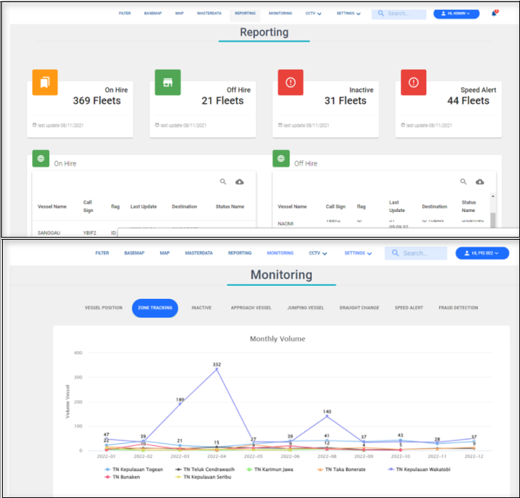
Atlas pre-built report & monitoring consists of:
- Vessel statistic based on status (On Hire, Off Hire, Inactive dan Speed Alert)
- Vessel on restricted area or specific area to monitor and approach vessel
- Vessel jumping from one location to another at an unreasonable distance
- Draught change in a certain category and time
- Speed alert and config
- Fraud detection
Other Functions
The following is the list of other functions available on Atlas v1.0.1 :
- Cursor Coordinate
- Map Bookmarking
- Geofencing
- Automatic Reporting
- User Management
- Ship Master Data Management
- Port Data Management
- Electronic Navigational Chart (ENC)
- Alert

